

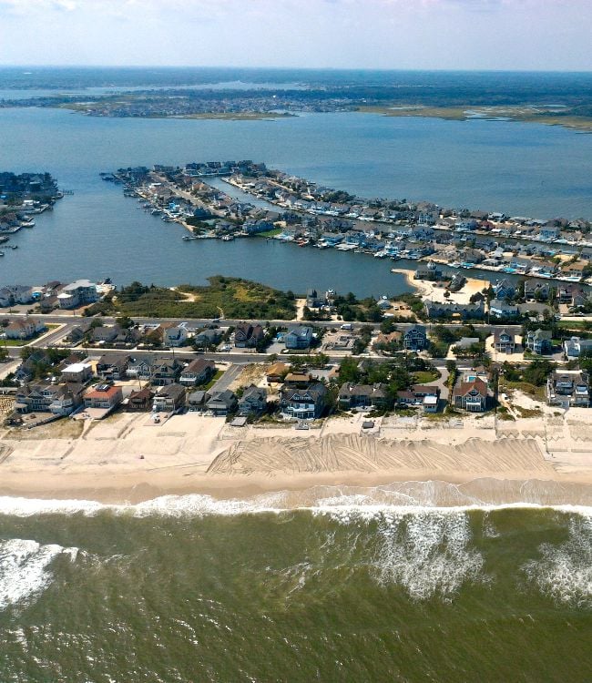
An early September nor'easter is not just a weather event to track on your phone. For homeowners from New York City to Boston, it's a direct threat to property, and the timing makes it harder to manage than most people expect. Trees are still fully leafed out, coastal properties are sitting at peak exposure after a long summer season, and the mental shift to storm preparedness hasn't happened yet the way it does in November or December.
The biggest concerns here are not abstract. Wind damage from heavy tree canopies, repeated coastal flooding across multiple high tides, shoreline erosion, roof leaks from prolonged wind-driven rain, and power outages that stretch for days are all real outcomes tied to this kind of storm. These are not worst-case scenarios pulled from a dramatic forecast. They are the practical consequences of an early-season coastal storm hitting homes that were not built or maintained with September nor'easters in mind.
Where you live and what kind of property you own will shape how much of this actually lands on your doorstep. A waterfront home on Long Island faces a completely different set of risks than an older triple-decker in a Boston neighborhood with large street trees overhead. Both can take serious damage, but the damage looks different, and so does the preparation. This article is built around helping you understand exactly what's coming for your type of home, without comparing this storm to famous historic events in ways that either overstate or understate the real threat.
Why This September Storm Could Be Hard on Homes
Most nor'easters that make headlines hit in late fall or winter, after leaves have dropped and homeowners have already run through their seasonal prep checklist. This one arrives in September, which changes the math on several fronts.
The most immediate issue is the tree canopy. In September, trees across the Northeast are still carrying their full summer foliage, and that foliage acts like a sail in high winds. A mature oak or maple with a full crown can catch an enormous amount of wind load, and when the soil beneath it is already saturated from prolonged rain, the root system loses its grip faster than most people expect. That's when limbs come down on roofs, driveways, and power lines, and in some cases, whole trees follow.
Official forecasts for this storm have flagged strong sustained winds, extended periods of heavy rain, coastal flooding, and meaningful erosion potential. That combination is not a rainy weekend that inconveniences your commute. It's a setup that can produce expensive property damage even without hitting the extreme end of the forecast range. Coastal flooding in particular is not a single event with a clean ending. Most coastal areas experience two high tides per lunar day, which means flood conditions can build and return across multiple cycles rather than receding after one peak.
September also catches many homeowners off guard simply because the season doesn't feel like storm season yet. Summer furniture is still on the deck, gutters may be clogged with late-summer debris, and backup power plans haven't been revisited since last winter. That gap in readiness is exactly what makes an early nor'easter more costly than it needs to be.
The Home Risks That Matter Most First
Wind and tree damage sit at the top of the risk list for most homeowners in this storm's path. Full tree canopies combined with saturated ground are a particularly dangerous pairing because the roots that normally anchor large trees lose stability when the surrounding soil turns soft. Limbs and whole trees that fall during this kind of storm can punch through rooflines, block driveways, sever utility lines, and damage neighboring structures. The damage is often sudden and concentrated in specific spots rather than spread evenly across a neighborhood.
Repeated coastal flooding is the second major hazard, and it's one that catches people off guard because it doesn't follow a simple timeline. Rather than one flood event that peaks and retreats, a prolonged coastal storm can push water inland across two or more high tide cycles per day. The first tide might flood a parking area or a low street. The second tide, arriving roughly twelve hours later, can push water further onto lots and into garages, crawl spaces, or utility areas that stayed dry during the first cycle. When astronomical tides are already elevated near a full moon, the starting point for each flood cycle is higher before any storm effects are even added.
Erosion and wave action add a third layer of concern, particularly for waterfront properties. Dunes, shoreline access points, and the edges of waterfront lots can weaken significantly over a multi-tide storm event. This kind of gradual structural loss doesn't always look dramatic in the moment, but it can compromise the long-term stability of the land itself.
Beyond those three, roof vulnerability deserves serious attention, especially for older homes. Wind-driven rain behaves differently from rain falling straight down. It finds gaps around flashing, penetrates aging shingle edges, and forces water into spaces that a normal rainstorm would never reach. A roof that passed last year's inspection can still develop leaks under sustained sideways rain pressure.
Power outages round out the picture as a damage multiplier rather than just a convenience issue. When the power goes out, sump pumps stop working, which means basements and crawl spaces that would have stayed dry can flood. Refrigerated medications and food become a problem within hours. Electric gate systems and garage doors can trap cars inside. In neighborhoods where tree debris blocks roads, utility restoration crews can take days to reach affected areas, which stretches every one of these problems further.
Which Homeowners Should Be Most Concerned
Waterfront and low-lying coastal homeowners carry the highest combined exposure in this storm. Repeated tidal flooding, erosion, and wave action all converge on properties that sit close to the water's edge, and the damage can accumulate across multiple tide cycles before conditions even begin to ease.
Homes near mature trees face a different but equally serious set of risks. Falling limbs are the obvious concern, but the downstream effects matter too, including blocked driveways that prevent you from leaving or getting help in, damage to overhead service lines that extends outages, and roof punctures that let water in for days before repairs are possible.
Older homes and properties with aging roofs are more vulnerable to wind-driven rain and flashing failure than newer construction. A roof that's fifteen or twenty years old may not be visibly deteriorating, but the seals around chimneys, skylights, and vents can fail under the kind of sustained sideways rain pressure this storm is expected to produce. Water intrusion from a failed flashing point can spread far beyond the entry point before it shows up as a stain on a ceiling.
Neighborhoods with a history of outage problems face a longer road back after a storm like this, especially where tree debris is heavy. Even homes that escape direct structural damage can end up dealing with days without power, which affects sump pumps, heating systems, and anything that depends on electricity to protect the home from secondary damage.
It's also worth noting that serious property problems are not limited to homes directly on the shoreline. Drainage issues, fallen trees, and blocked access roads can affect neighborhoods well inland from the coast. The storm's reach is wider than the flood zone maps alone would suggest, and homeowners in those in-between areas should not assume their distance from the water provides full protection.
What Repeated Tides and Rain Mean in Real Life
Forecast language tends to describe coastal flooding in terms of peak surge heights and timing windows, which is useful for emergency managers but harder to translate into what actually happens to a home over the course of a storm. The mechanics are worth understanding clearly.
Most coastal areas along the Northeast experience two high tides per lunar day, roughly twelve hours apart. During a prolonged nor'easter, that means flood conditions don't arrive once and leave. They cycle. The first high tide might push water into low-lying streets and parking areas. By the time that water recedes, conditions are already building toward the next cycle, and if the storm is still delivering wind and surge energy, the second tide can push water further than the first. In some cases, the third or fourth tide cycle is the one that actually reaches garages, crawl spaces, and utility areas that survived the earlier rounds.
Astronomical tides compound this. When a storm coincides with a full or new moon, tidal ranges are already elevated above their monthly average, which means the baseline water level is higher before storm surge is added. That extra foot or two of starting height can be the difference between water staying in the street and water entering a structure.
Prolonged rain works on a separate but connected track. Soil has a saturation threshold, and once that threshold is crossed, water stops absorbing and starts running. Drainage systems, both municipal and residential, can handle a certain volume before they back up. When rain continues for twelve to twenty-four hours or more, those systems reach capacity and standing water builds in yards, window wells, and low areas around foundations. That same saturated soil is also what makes tree roots unstable, connecting the flooding risk directly back to the wind and tree damage problem.
Impassable roads are a real outcome of this combination. When streets flood repeatedly across multiple tide cycles and storm drains are overwhelmed, access to and from affected neighborhoods can be cut off for extended periods, which delays emergency response, prevents cleanup crews from reaching damaged properties, and leaves homeowners isolated longer than a single-event flood would.
Where Impacts Could Feel Worst From New York to Boston
Geography shapes everything about how a nor'easter lands, and the stretch from New York City to Boston contains some of the most varied and storm-sensitive coastal terrain on the East Coast.
Long Island and the New York City coastal fringe carry a specific vulnerability tied to back-bay flooding. While ocean-facing beaches take the direct wave action, the bays and inlets behind barrier islands can fill with water that has nowhere to drain during a sustained storm. Areas around Jamaica Bay, the South Shore bays, and low-lying coastal neighborhoods in Queens and Brooklyn have flooded repeatedly in past storms, and the multi-tide setup in this forecast creates conditions for that pattern to repeat. Beach erosion and surf impacts will also affect oceanfront communities from the Rockaways east through the Hamptons.
Moving north, harbor-adjacent and low-lying areas around Boston face a combination of tidal flooding and wind exposure that the city's geography amplifies. Boston Harbor funnels storm surge into surrounding neighborhoods, and areas like East Boston, South Boston, and parts of the North Shore have documented histories of tidal flooding during significant coastal storms. Transportation disruption is also a serious secondary effect in this region, since flooded roads and downed trees can cut off access to major corridors.
Eastern Massachusetts, including communities along the South Shore and the outer coast, sits in a zone where wind exposure and erosion risk are both elevated. These communities face some of the most direct fetch from a northeast storm track, meaning waves and surge have a long open-water run before hitting the shoreline.
Cape Cod deserves particular attention because the combination of high-value waterfront properties and naturally dynamic shorelines creates conditions where even a moderate but prolonged storm can produce meaningful damage. Dunes and bluffs along the outer Cape are actively eroding under normal conditions, and a multi-tide nor'easter accelerates that process significantly. Homeowners with properties near the water's edge on the Cape should treat this storm seriously regardless of how the peak intensity numbers compare to past events.
How to Judge the Threat Without Falling for Hype
Every significant coastal storm invites comparisons to past blockbuster events, and this one will be no different. The problem with those comparisons is that they set a mental threshold that most storms will never reach, and that can lead homeowners to underestimate a storm that doesn't carry a famous name or a record-breaking headline.
A nor'easter doesn't need to match the scale of a Sandy or a Bob to cause thousands of dollars in property damage. A roof leak that goes undetected for two days after a storm, a basement that floods because the sump pump lost power, or a fallen tree that blocks the driveway and damages the garage can each generate insurance claims and weeks of disruption. Those outcomes don't make the news, but they happen in large numbers during storms that most people would describe as moderate.
The more useful question is not how this storm compares to the worst storm in regional memory. The more useful question is what your specific property is vulnerable to right now. A home with a fifteen-year-old roof near a stand of mature oaks in a neighborhood with a history of outages faces a very different risk profile than a newer construction home on higher ground with no significant trees nearby. Broad regional comparisons don't capture that difference, but a clear-eyed look at your own property does.
Focusing on the hazards most likely to affect your home, repeated tidal flooding, tree damage, erosion, roof leaks, and outages, gives you something actionable. It also keeps the threat in perspective. This storm warrants serious preparation and real attention. It does not warrant panic or the assumption that every coastal property from New York to Boston will suffer catastrophic damage. The homeowners who handle it best are the ones who understand their actual exposure and act on it, not the ones who either dismiss the storm entirely or assume the worst without any basis for that conclusion.
What Homeowners Can Do Before Conditions Get Worse
Getting ahead of a storm like this comes down to a short list of practical steps that are easy to skip when the forecast still feels abstract but genuinely matter once conditions deteriorate.
- Move cars away from flood-prone curb areas, low lots, and spots directly under large trees. Vehicles damaged by falling limbs or submerged in floodwater are a costly and avoidable outcome, and moving them costs nothing.
- Secure outdoor furniture, trash bins, and any loose yard items before winds increase. In gusty conditions, unsecured objects become projectiles that can damage siding, windows, and neighboring property.
- Clear gutters and downspouts if it is safe to do so, particularly in areas where standing water tends to collect near the foundation. Blocked gutters during a prolonged rain event can push water behind fascia boards and into the roof structure.
- Charge phones, portable batteries, and any backup power sources now. If outages last longer than expected, a charged backup can keep a sump pump running, power a medical device, or maintain communication when it matters most.
- Photograph the vulnerable parts of your property before the storm arrives. Roof condition, exterior walls, fences, and any areas near trees or the shoreline are all worth documenting. If you need to file an insurance claim, having pre-storm photos establishes a clear baseline.
Checking your insurance coverage before the storm is also worth doing. Standard homeowners insurance policies typically do not cover flood damage, which means homeowners in flood-prone areas who don't carry a separate flood policy through the National Flood Insurance Program or a private insurer may find themselves without coverage for some of the most likely damage this storm can produce. Knowing where your coverage stands now is far better than discovering a gap after the water recedes.
Final Thoughts
A September nor'easter doesn't follow the same rules as a late-season storm when trees have already dropped their leaves and the ground has had time to firm up. The combination of fully leafed trees, saturated soil, and repeated coastal flooding across multiple high tides creates pressure on East Coast homes that's genuinely different from what most homeowners expect in early fall.
Knowing which risks apply to your specific situation is what makes the difference between reactive cleanup and smart preparation. A home near mature trees faces falling limb damage and extended outages. A waterfront property faces erosion and multi-tide flooding. An older home with an aging roof faces wind-driven water intrusion that can spread silently through the structure for days. None of these risks require a record-breaking storm to cause real financial damage, and none of them are beyond your ability to prepare for.
Checking your flood insurance coverage, photographing your property, moving vehicles, and securing loose items are all steps you can take today. The homeowners who act before conditions worsen are the ones who spend less time dealing with the aftermath, and that's a position you're fully capable of putting yourself in before this storm arrives.
Check out this article next